 |
| Sign for Paritu near Opoutere School in Wharekawa Valley Photo CRB 2010 |
Heading North from
Whangamata one winds through part of Wharekawa Valley. Past Taungatara ( where once there was
mining up at "Luck at Last" and now still logging ). Past an old sawmill from mid 1900's ( McGauchran the proprietor in the past ). Past the early settlement of
Paritu, Opoutere School and Tawa Tawa Hall flanked - only just - in 2014 by a
Redwood Grove planted in the early 1930's.
 |
| Redwood Grove near Tawa Tawa Hall - Photo by CRB 2010 |
This Wharekawa, in the
19th Century, was often referred to as Wharekawa East by early European
settlers, being on the Eastern Coast of the Coromandel Peninsula. This was to
avoid confusion with another Wharekawa which was opposite Grahamstown on the Western
side of the Firth of Thames.
Settlement in the area
saw close social and cultural links with the other settlements that sprang up
on the Eastern Coast of the Coromandel Peninsula – Tairua, Hikuai, Ohui,
Opoutere, Paritu, Onemana, Whangamata, Otahu, Parakiwai and nearby Whiritoa.
Living and activity closely linked and inter- twined. Typical of rural New Zealand communities where farming, forestry and fishing were a part of the past. School and rugby focal points of community activity along with of course the Tawa Tawa Hall - both in Wharekawa Valley and in the neighbouring Tairua Valley Tairua, Puketui and Hikuai - well known names amongst the communities of the 1900's - Savage, Douglas, Durrant and McGregor and from the other valleys Watt, Patton, Morrison, Laycock, Thomson.
 |
| Redwood Forest Grove at back of Tawa Tawa Hall - photo by CRB 2010 |
What is known as Opoutere School today in 2014 was not always so. The original building, of what was known as Wharekawa School opening in 1908, is still down at the Youth Hostel, overlooking the dotterel colony ,on the harbour spit. The school seen today moved in 1954 to its present location.
In 2013 the Tairua Rugby Club celebrated its 125 years and Whangamata Rugby Club 50 years. Both clubs well supported by Wharekawa Valley families of the past.
Wharekawa Valley is the
place where prolific and respected author and historian made his home at
Opoutere from 1993 until his sudden death in March 2004. He wrote many books on
New Zealand History His book the Penguin
History of New Zealand (2003) written at Opoutere is said to have become a best seller, figures
having reached more than 200,000.
Today in 2012 we are reminded of Michael
King’s life as an author in the Michael King Memorial reserve that bears his
name in the small settlement of Opoutere, on the edges of the Wharekawa
Harbour. Along with a memorial sculpture created by well-known potter Barry
Brickell.
 |
| Memorial Sculpture Work by Barry Brickell - photo by CRB 2010 |
If sitting in this place looking out across the waters of the Wharekawa
Harbour, one of Michael King's books published in 1993 (a favorite of mine)
comes to mind - "The Coromandel."
 |
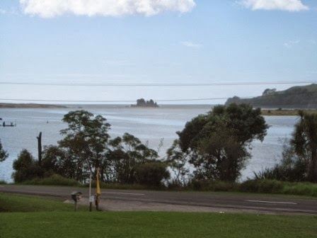
| Looking at Harbour Mouth from Michael King Reserve - Photo by CRB 2010 |
Some Wharekawa Geography and Geology
The area is typical of
that of the Coromandel Peninsula landforms, formed of volcanic activity
millions of years ago leaving the landscape we have today – the Wharekawa
Caldera, the razor back ridges and bluffs of the Wharekawa Valley, the coastal
wetlands of the Wharekawa estuary. The andesite and rhyolite rock of the hills
of the ranges which are the backdrop of the valley and estuary.
 |
| The Ocean Beach looking toward Ohui - Photo by JMS 1970's |
Reference Source :
- King, Michael. The Penguin History of New Zealand. London, England: Penguin Books Ltd, 2003.
- Williamson, Beverley M. Whangamata - 100 Years of Change. Paeroa, New Zealand: Goldfields Print Ltd, 1988.
- Ohinemuri Journal http://www.ohinemuri.org.nz/journal/journal_index.htm
No comments:
Post a Comment