Friday 10 January 2014

Wharekawa Valley - Wharekawa East


Sign for Paritu  near Opoutere School in Wharekawa Valley
Photo CRB 2010 
Heading North from Whangamata one winds through part of Wharekawa Valley. Past Taungatara ( where once there was mining  up at "Luck at Last" and now still logging ). Past an old sawmill  from mid 1900's ( McGauchran the proprietor in the past ). Past the  early settlement of Paritu, Opoutere School and Tawa Tawa Hall flanked - only just - in 2014 by a Redwood Grove planted in the early 1930's.


Redwood Grove near Tawa Tawa Hall - Photo by CRB  2010

This Wharekawa, in the 19th Century, was often referred to as Wharekawa East by early European settlers, being on the Eastern Coast of the Coromandel Peninsula. This was to avoid confusion with another Wharekawa which was opposite Grahamstown on the Western side of the Firth of Thames.

Settlement in the area saw close social and cultural links with the other settlements that sprang up 
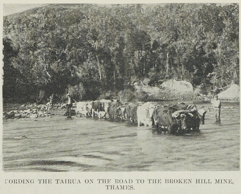
on the Eastern Coast of the Coromandel Peninsula – Tairua, Hikuai, Ohui, Opoutere, Paritu, Onemana, Whangamata, Otahu, Parakiwai and nearby Whiritoa.

Living and activity closely linked and inter- twined. Typical of rural New Zealand communities where farming, forestry and fishing were a part of the past. School and rugby focal points of community activity along with of course the Tawa Tawa Hall - both in Wharekawa Valley and in the neighbouring Tairua Valley  Tairua, Puketui and Hikuai  - well known names amongst the communities of the 1900's - Savage, Douglas, Durrant and McGregor and from the other valleys Watt, Patton, Morrison, Laycock, Thomson.

Redwood Forest Grove at back of Tawa Tawa Hall - photo by CRB 2010

What is known as Opoutere School today in 2014 was not always so. The original building, of what was known as Wharekawa School opening in 1908, is still down at the Youth Hostel, overlooking the dotterel colony ,on the harbour spit. The school seen today moved in 1954 to its present location.

In 2013 the Tairua Rugby Club celebrated its 125 years and Whangamata Rugby Club 50 years. Both clubs well supported by Wharekawa Valley families of the past.
 
Wharekawa Valley is the place where prolific and respected author and historian made his home at Opoutere from 1993 until his sudden death in March 2004. He wrote many books on New Zealand History  His book the Penguin History of New Zealand (2003) written at Opoutere  is said to have become a best seller, figures having reached more than 200,000. 

Today in 2012 we are reminded of Michael King’s life as an author in the Michael King Memorial reserve that bears his name in the small settlement of Opoutere, on the edges of the Wharekawa Harbour. Along with a memorial sculpture created by well-known potter Barry Brickell.

Memorial Sculpture Work by Barry Brickell -  photo by CRB 2010

If sitting in this place looking out across the waters of the Wharekawa Harbour, one of Michael King's books published in 1993 (a favorite of mine) comes to mind - "The Coromandel."

Looking at Harbour Mouth from Michael King Reserve - Photo by CRB 2010


Some Wharekawa Geography and Geology


 On  the "other stuff" I find fascinating about "living on the Coromandel" - some of the geography and geology - the stuff that gave the Wharekawa its "humps and bumps." The Wharekawa river flowed through this valley and down to what was known as the Wharekawa Estuary and out to sea. Small streams such as what is now called the Inca Stream fed into the upper reaches of the Wharekawa River.

The area is typical of that of the Coromandel Peninsula landforms, formed of volcanic activity millions of years ago leaving the landscape we have today – the Wharekawa Caldera, the razor back ridges and bluffs of the Wharekawa Valley, the coastal wetlands of the Wharekawa estuary. The andesite and rhyolite rock of the hills of the ranges which are the backdrop of the valley and estuary.

 Seems as if the “humps and bumps" of this area have made an ideal foundation for settlers of a different kind to the Wharekawa Harbour - Dotterels. These birds have made their home on the sandspit near the harbour mouth entrance joining many other sea and wading birds. 

 The Ocean Beach looking toward Ohui - Photo by JMS 1970's

 Wharekawa - a valley very much a part of the past New Zealand History.

Reference Source :
  • King, Michael. The Penguin History of New Zealand. London, England: Penguin Books Ltd, 2003. 
  •  Williamson, Beverley M. Whangamata - 100 Years of Change. Paeroa, New Zealand: Goldfields Print Ltd, 1988. 
  •  Ohinemuri Journal http://www.ohinemuri.org.nz/journal/journal_index.htm


Thursday 9 January 2014

Majestic Kauri


Tane Mahuta
                                                      
Kauri - part of the past New Zealand history long ago. Mighty Kauri symbolic of strength and resilience – “Majesty of the Forest”.  A reminder of its size and longevity in New Zealand’s most famous Kauri “Tane Mahuta” in Waipoua Forest, said to be more than 1500 years old. Another Kauri nearby - “Te Matua Ngahere” - said to be even older estimated at between 2000 and 3000 years old.

Kauri once grew extensively Northwards from Auckland, the Coromandel Peninsula and Southwards toward a line Raglan to Tauranga.


 Juvenile Kauri - photo CRB 2009
 
                                                                        
The light, straight grain, durable timber of Kauri was sought for canoe, ship masts and spars, boat building, railway carriages, house and commercial buildings and furniture making. The gum of the Kauri was sought for the manufacture of paints and resins.  Some found the gum useful for sweetening the breath and as “chewing gum”.
      Kauri 309 road photo J M Stewart 1970's
                                                     
Today Kauri is a scarce resource treasured and looked after, used only for special purposes. The resilience of Kauri is seen in seedlings springing up on the forest floor and in places, Kauri rearing their majestic crowns above the forest canopy once more.  The Kauri 2000 project is seeing the reestablishment of Kauri, our “majestic tree of the forest,” in planting projects that will see it there for future generations.
Driving on the Kopu - Hikuai highway ( State Highway 25 A ) in 2014 - scenic highway opened in 1967, giving access across the range - can be seen the crowns of kauri trees raising their heads once more above the bush canopy. Near to Tairua / Pauanui off this highway is the Devcich Kauri. Said to be the ninth largest kauri left on the Coromandel Peninsula it is said to measure Girth 10.54 m (34.5'), trunk height 12.55 m (41'), total height 46.5 m (152.5').

Kauri Forest Waitakerei
In The Cyclopaedia of New Zealand, Vol 2, Auckland Province.
Christchurch: Cyclopaedia Company Limited, 1902

DEFIANCE

Defiant, stood, the Kauri tall, Defiant, against other's  plan.
But, for, a ship's mast and sail,
 The Kauri , fell, at their hand.
 Defiant, lay, the Kauri seed, Defiant, against, other's  toil.
 To overcome,  waste and greed
 Put, new roots down, into the soil. 
 Defiant, grew, the Kauri shoot, Defiant, not, to disappear.
 By sharp, axe and heavy, boot, 
Instead, its crown, it did rear.
 Defiant, grew, the Kauri tree, In spite, of plans, of others

 This, is the way, things will be. 
For the Kauri, is part, of Nature's Plan

Poem by ASB 

Taken from the supplement to the Auckland Weekly News 24 JUNE 1909 p007 FINE SPECIMENS OF THE KAURI TREE ON THE ROAD TO NEAVESVILLE. THAMES, AUCKLAND,  N.Z. Courtesy Auckland Libraries Heritage Collections AWNS-19090624-7-2


Sunday 5 January 2014

Tairua Broken Hills Gold mining Company


       Directors Visit Tairua Broken Hills Gold Mining Company
From left William Frater, Major Holgate, Richard Mitchelson, Alex Alison, William Blomfield, Hugh Alison, Sir Edwin Mitchelson, Henry Thomson Gorrie, Henry Hopper ( AKA Harry ) Adams, other two launchmen.
Photo also in
Weston, Fred (Compiler) Jubilee Souvenir - Thames Goldfields: A History From Proclamation Times to 1927. Thames "Thames Star" July 1927

Tairua Goldfields – The Location

Mr. Bell, in a report , made the following observations:-
  •         Tairua Goldfield is situated in a hilly, almost mountainous country. 
  •     A natural highway into the goldfield is afforded by the Tairua Harbour and river.
  •       a rough road extends up the flood plains of the Tairua Stream for several miles, and then a corduroy or log track leads over the hills past the various mines down into the valley of the Puriri, on the western side of the divide. (Bell, AJHR 1908 Session I, C-09)
Kauri Source: Kirk, T. F.L.S. The Forest Flora of New Zealand. Wellington: Government Printers, 1889 Logs on a Rolling Road  from a photograph by Foy Brothers. An example of the 'corduroy road" Bell writes about:  

A location such as this goldfield, would have had importance for mining operations in the late 1880'S early 1900's for transport of machinery and people.
The nature of the geography of the Tairua Goldfields - photo CRB 2012

The Gold mining Company

In the area of known as the Lower Tairua Mining Area, gold was said to have been found in what was known as the Broken Hills Claim in 1895. This led to others coming to the area in the vicinity of the Broken Hills Claim in the hope, of may be, another “El Dorado.”
Mine Shaft Tairua Broken Hills, Puketui Valley - Photo CRB 2008
 
Specimens were sent to the School of Mines which came back with what were considered favourable reports –

 a trial crushing yielding, from 1 ton of ore, bullion to the value of £69” (Bell, 1912, P14 )

            Thames School of Mines - 2014 still there as a Heritage destination - Photo CRB 2009
                           
There then entered on the Broken Hill Claim scene, one London based company who promptly registered the claim as the New Zealand Broken Hills Gold Mining Company Limited. The Auckland Star reported:-

“Mr Hansen, who has charge of the works, says the ore is much richer than on, the surface. Some time ago, 18cwt yielded £70 worth of bullion at the School of Mines.” (Auckland Star, 09/07/1896)

Capital flowed freely as this London based company began construction of water- races and a tramway. A 20 stamp battery was also purchased – before any payable ore was properly realised. Business sites for the Broken Hills Tairua battery, Post Office, houses and school, were surveyed off. ( the small settlement of Puketui- said in its heyday, to be about 300 people.

Plan of business sites, Broken Hills, block Vi, Tairua SD / H.D.M. Haszard surveyor ; W E Ballantyne draftsman. Sourced from LINZ. Crown Copyright reserved.' Archived by the National Library of New Zealand in TIFF.


It would seem also from newspaper accounts that the County Engineer had other ideas on the track being constructed between the Broken Hills Mine and the Upper Landing:-

" As to Knox and Co.'s objection to the proposed line of road between the Broken Hills mine and the Upper Landing the Engineer reported that the track constructed by Seavers' syndicate was objectionable because it crosses and re crosses the Tairua river a number of times, but his idea was to go to the Upper Landing as only one crossing would be necessary.—This matter was left entirely with the Engineer.'(Thames Star, 3 June 1897, Page 39)
 
Sides of Gorge, Tairua Broken Hills, Puketui Valley - Photo CRB 2008


After only two years of hard work and capital expenditure, the London based company, headed by Jonathan Seavers locally, gave up gold mining at Tairua Broken Hills in favour of a local syndicate who purchased the claim, the workings along with the plant and machinery.
 

The Local Syndicate

 
 “To-day the recently-formed The Tairua Broken Hills Gold Mining- Company (Limited) was registered under the Companies Act, 1882, the first directors being- Messrs H. T. Gorrie, John McCombie, H. H. Adams, H. A. Gordon. Thomas Morrin, E. W. Alison, D. G. MacDonnell, and secretary Mr J.B. Sheath. The office is situated at No. 11, New Zealand Insurance Buildings, Queen street. The nominal capital of the company is £12,500, divided into 125,000 shares of 2s each. Mr H. A. Gordon has been appointed chairman of directors, and Mr H. H. Adams managing director at the company's mine at Tairua.” (Auckland Star, 13/07/1899, p.5)

First NZI Building demolished during World War 1 - In The New Zealand Insurance Company Limited. Bold Century .Auckland: The New Zealand Insurance Company Limited, 1959 

Typical of most Coromandel Peninsula Mining Companies in this era, Tairua Broken Hills Gold mining Company advertised their offices as being in the New Zealand Insurance Building.

These first directors of the Tairua Broken Hills Gold mining Company were certainly no strangers to goldmining on the Coromandel Peninsula and had been involved as directors and or managers  of a number of gold mining companies.

 
The newspapers reported personnel developments with both Henry Hopper Adams ( AKA H.H. Adams) and John McCombie ( AKA J McCombie )appointed to report on and prepare a plan of operation ( Thames Star,  14 July 1899, Page 4 


Mr. H.H. Adams photo courtesy  Sir George Grey Special Collections,    
Auckland Libraries, AWNS-19270728-47-13’Auckland City Libraries Heritage images

J McCombie
 The Cyclopaedia of New Zealand, Vol 2, Auckland Province. Christchurch: Cyclopaedia Company Limited, 1902.


Tairua Broken Hills Gold Mining Company moved rapidly towards being operational. The Auckland Star carried news of  the transport of machinery and material to the battery site aboard Scow Orakei, Captain Wilson.:-

" The well known scow Orakei on the 11th November berthed at the Tairua Broken Hills Gold Mining Company's wharf, upper landing. She brought boiler, engine, and other machinery, a quantity of railway iron, bricks, and timber for the new battery at Broken Hills, some 80 tons in all. Mr Norman McLeod has secured the contract for conveying the machinery, etc., from the company's wharf to the battery site, a distance of four miles." (Auckland Star ,23 November 1899, Page 6)

FORDING THE TAIRUA ON THE ROAD TO THE BROKEN HILL MINE,THAMES. photo courtesy
Auckland Libraries Heritage Collections NZG-18991104-828-1

By 1903 Tairua Broken Hills Gold mining Company was up and running. Several visits had been made by the directors to the mine as well as enjoying fishing in the area. There were also several changes of directors - The Hon Edwin Mitchelson as Chairperson and with  William Blomfield and James Smith appointed on retirement of Henry Gordon ( AKA H.A. Gordon) and Thomas Morrin in 1901. Henry Thomson Gorrie remained as a director.

Mine Relics  Broken Hills Tairua Photo CRB 2008
                                                                            
In 1903 the Mines Statement wrote on Tairua Broken Hills :-
 
"Tairua Broken Hills Mine, which is now held by an Auckland company, has had a very  successful year. The mill, of twenty-stamp capacity, is well fitted out with gold-saving appliances, including cyanide plant ; and the stone in the mine looks promising. ( Mines Statement , 1903 )
                                         
Sign for walking track Tairua Broken Hills - Photo by CRB 2008
                                            
Today in 2014 Tairua Broken Hills is a recreation area - part of the past New Zealand History.

Start of Broken Hills Walking Track in 2008 -  Photo by CRB 2008

Reference Source: 
  •  Bell, James Mackintosh, and Colin New Zealand Geological Survey Branch Fraser. 1912. The geology of the Waihi - Tairua subdivision, Hauraki division. Wellington, New Zealand: John Mackay, Government Printer.
  • Downey, F. Gold Mines Of The Hauraki District, New Zealand. G.B. Loney, Government Printer . Wellington: G.B. Loney, Government Printer, 1935.
  • Kirk, T. F.L.S. The Forest Flora of New Zealand. Wellington: Government Printers, 1889
  • Weston, Fred (Compiler) Jubilee Souvenir - Thames Goldfields: A History From Proclamation Times to 1927. Thames "Thames Star" July 1927
  • NEW ZEALAND GEOLOGICAL SURVEY DEPARTMENT (SECOND ANNUAL REPORT (NEW SERIES) OF THE). Appendix to the Journals of the House of Representatives, 1908 Session I, C-09 National Library New Zealand Atols Online    
  • Mines Statement 1903 NEW ZEALAND. PAPERS AND REPORTS RELATING TO MINERALS AND MINING COMPRISING STATEMENT BY THE MINISTER OF MINES. REPORT ON THE GOLDFIELDS. REPORT ON COALMINES. REPORT ON STATE COAL-MINES. WELLINGTON BY AUTHORITY: JOHN MACKAY, GOVERNMENT PRINTER.  1903. Archive Internet - Mines Statement 1903 NZ
  •   Newspapers - The Auckland Star, The New Zealand Herald, Thames Star Papers Past National Library New Zealand